
Until recently, Southern Water’s Beachbuoy web page has been a simple facility, limited to just a few sites and arguably simply a PR exercise given the criticism frequently levelled at the company. Over the past few weeks however, we have been pleased to see that the basic function of the original page has been replaced by a new version with significantly greater geographical scope with access to much more current and historic data. The SPS Pollution Group have been monitoring spill data from Beachbuoy during May and June and will publish the results soon
Take a quick look through the example given in rest of this post before clicking on the image below to open the Beachbuoy page in a new browser tab. From there you will be able to search for the current detail in your local area of the Solent.
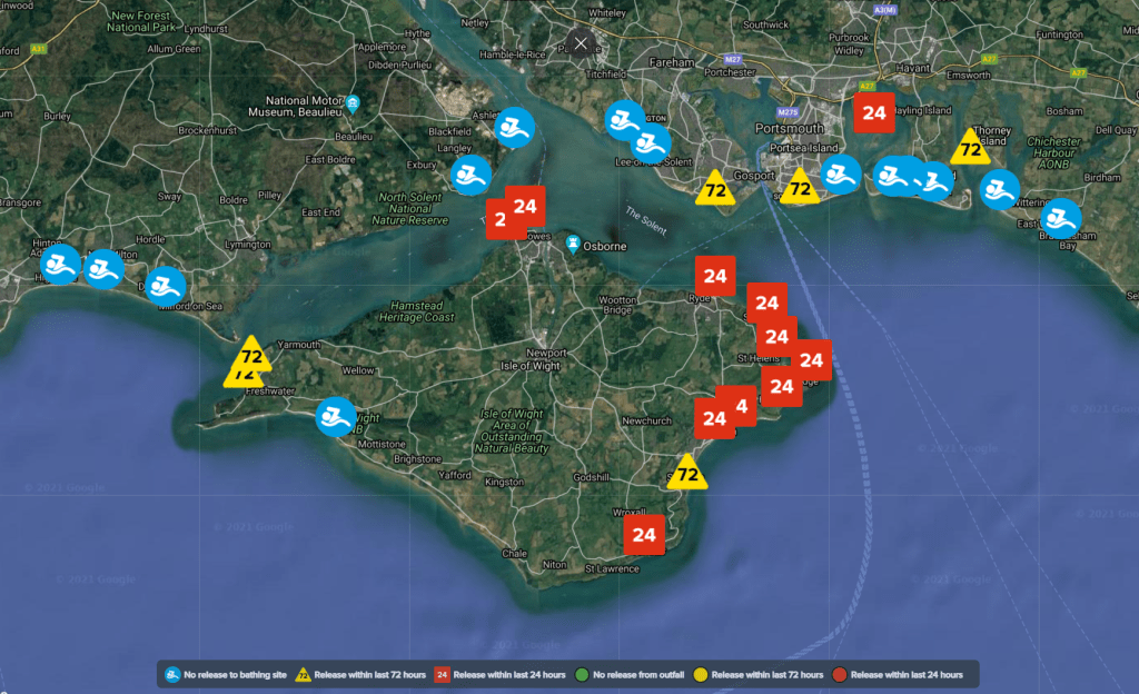
When you first open the page and scroll down a little, you will find an interactive map through which you can scroll and zoom into the Solent, displaying a view similar to that below. Various coloured icons display the status of the designated bathing beaches within the area and in ideal conditions should show all show as blue icons.
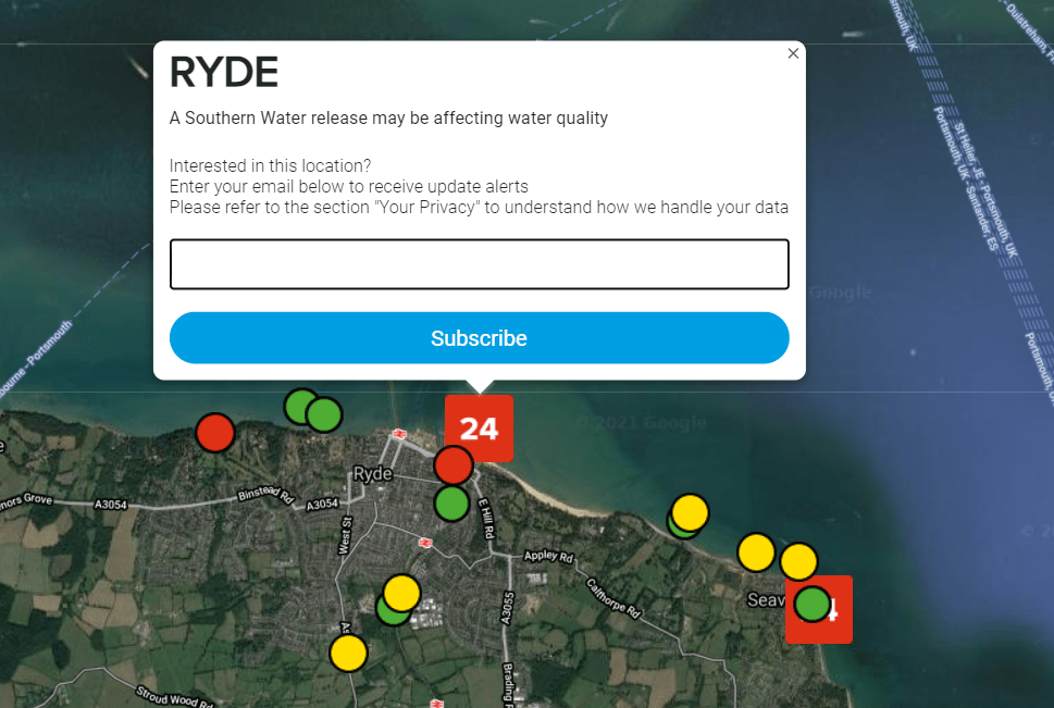
In this example, we have zoomed in on Ryde, which is showing that there has been a ‘Release with the last 24 hours’. Clicking on the red icon brings up the detail in the image below. Each of the local outfalls that might be affecting bathing water quality at Ryde are displayed with either a red, amber or green status and hovering over each outfall icon will display its identifying name. Above the main icon, an input box allows entry of your email address if you wish to be notified of future alerts affecting the bathing beach selected.
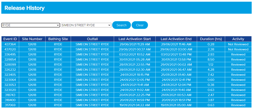
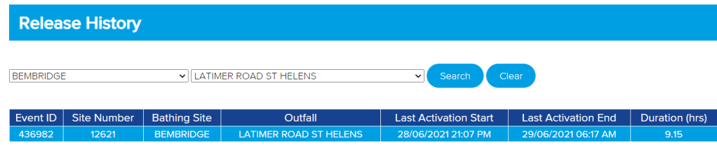
Further down the Beachbuoy page, the history of recorded spills from each individual outfall can be selected based on the initial selection of a ‘bathing beach’. The left hand selection field gives an alphabetic list of ‘bathing beaches’ while the right hand selection box shows the combined sewer outfalls which correspond to the selected bathing beach.
It’s worth noting that the definition of a ‘bathing beach’ is helpfully somewhat stretched. For example, both Langstone Harbour and Chichester Harbour have icons within them, selection of which helpfully displays the surrounding combined sewer outfalls. Given that precedent we will be working with our contacts at Southern Water to seek similar coverage for Portsmouth Harbour, Southampton Water and the main estuaries of the Western Solent.
Looking a little further east, let’s look at Bembridge and in particular, at the Latimer Road East outfall.
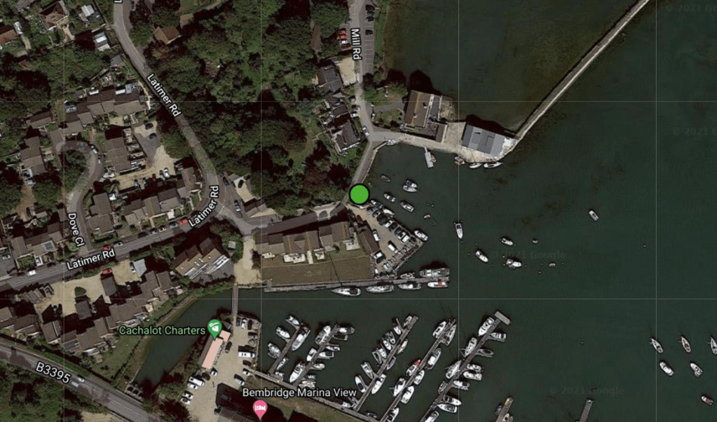
So what does that actually look like at the time of the spill? Here’s a video, captured by a member of the public at 22:16 on June 28th and widely shared on Facebook:
